
Overview
Explore the breathtaking landscapes of Himachal Pradesh, from the apple orchards of Kalpa to the ancient monasteries of Spiti Valley. A journey filled with adventure, spirituality, and unforgettable vistas.
Highlights
- Kalpa Village – A scenic Himalayan village famous for its apple orchards and views of the Kinner Kailash range.
- Rogi Village, Nako Lake, Tabo Monastery
- Dhankar Monastery, Hikim Village
- Kee Monastery, Kibber Village, World’s Highest Post Office (Hikkim)
- More Kaza Sightseeing, Chicham Bridge
Itinerary
- Altitude: 709 ft (216 m) to 6,725 ft (2,050 m)
- Time taken: 14 hours, 554 km
Manali is the closest major township en route to our base camp, Kaza. It is a beautiful hill station tucked away in the northern cusp of the Kullu Valley, which literally translates to ‘end of the habitable world’. The landscape is dominated by apple orchards and snow. Manali is also considered one of the most preferred destinations for skiing.
Manali has a wide range of hotels that you can choose from, according to your budget and preferences. Finding a room to spend the night is not an issue. It is important that you get enough rest today, in preparation for the grueling road journey to Kaza tomorrow.
- Altitude: 6,725 ft (2,050 m) to 12,467 ft (3,800 m)
- Time taken: 10 hours, 204 km. Transport from Manali at 6:00 AM
The thrilling drive to Kaza. Picture by Mark Rodrigues
The Rohtang and Kunzum passes are known for their notoriously bad traffic jams, making it all the more necessary to leave by 5.00 am. Drive out of Manali, and towards Batal via Rohtang pass on the Manali-Leh Highway. The road is not too good and is bumpy all through. From Gramphu, take a diversion towards the Gramphu – Batal – Kaza road.
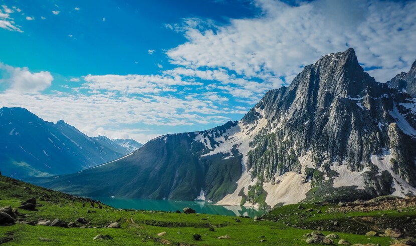
From Batal the route winds through the real Spiti Valley. Quaint little village tucked away in the mountains and arid landscapes dotted with green and yellow patches of peas and barley fields greet you. The route from here is straight out of a picture postcard. A hotel or homestay will be arranged for you at Kibber. The acclimatization process starts today.
Altitude: 12,467 ft (3,800 m) to 14,108 ft (4,300 m)
Time taken: 1 hour, 19 km (drive)
Altitude: 14,108 ft (4,300 m) to 15,748 ft (4,780 m)
Time taken: 6.5 hours, 5km
Trek gradient: Easy to moderate. Steep ascent for the first 3-4 hours after which the trail evens out into a level walk for a short while before ascending gradually.
Water sources: Carry 2 litres of water from Kibber. You can refill your water bottles at a lake, about an hour before reaching Kanamo base camp.
Camping style
The day starts with a trek to the Kanamo base camp. The trek from Kibber to Kanamo base camp is a continuous ascent for about 6 – 7 hours, as the trail winds through rocky slopes, grass and desert mountain valleys. You gain an altitude of more than 1,640 ft today. Starting with a steep ascent for the first 3-4 hours, the trail evens out a little thereafter. There is some level walk and then a gradual ascent again. Initially, soon after leaving the village, you cross numerous fields growing green peas. If it is the harvest season, you will even be offered delicious fresh peas by the locals. On the way, you pass two lakes, one of which supplies water to Kaza town. The last 2 hours of the trek are particularly picturesque with smaller varieties of Brahma Kamal and multiple types of flowers strewn all over.
Lake en route to KBCFossils enroute the Kanamo basecamp. PC – Vishi Bansal
Look out for interesting stones in this stretch as many of them are likely to be plant or animal fossils. The trek guides know to identify these, if you have not seen one earlier. Within a radius of about 1 km from the Kanamo base camp you will spot repositories of fossils of all types.
Altitude: 15,748 ft (4,780 m) to 19,553 ft (5,960 m) and back to 15,748 ft
Time taken: 12 -13 hours to climb and return
Trek gradient: Difficult. Continuous ascent to the peak, with the last 4 hours of climbing on a steep incline completely on scree. 2.5-3 hours of descent to return.
Water sources: None. Carry at least 2-3 litres of water from the base camp.
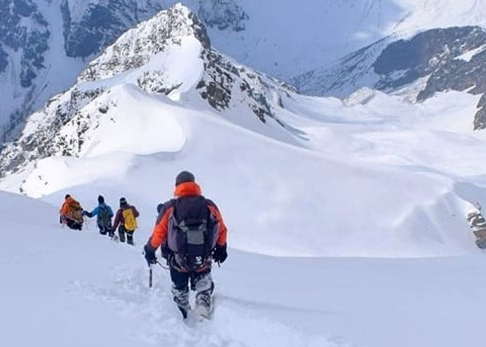
The summit attempt starts as early as 3:00 am. You cross the first shoulder in the mountain at dawn. Look out for the far off mountain ranges, divine in the sky’s changing colours. Soon you will be heading towards the second shoulder in the mountain. It gets increasingly cold and the wind bites. The bacalava is a must at this altitude, since the early morning breeze is ice cold. This walk of about 4 to 5 hours, is the last leg of the climb – a steep ascent of about 80 degrees on the scree slopes. The entire ascent is on scree from here. It is easy to slip down each time you take a step up. Small steps would be difficult to maintain, so make sure to take large strides to navigate the scree. If you find the last leg of the hike very difficult, be sure to take help from a guide, to avoid a fall. A four hour climb leads to the summit.
The view from the top is breathtaking. An astounding 360 degree view of the greater Himalayas is the best reward for the tough climb. One can see the Parang La pass leading to Ladakh, Pin Parvati pass leading to Kullu valley, ranges of Kinnaur, Lahaul and Spiti from the summit. At the back side of the peak is a huge glacier. Kanamo is actually a twin peak with its sister peak, Shila, next to it. Surprisingly, Shila is generally covered with snow,.
A trekker enjoying the stunning view of the mountains and the valley during descent. Photo by Ravindra Joisa.
The descent takes about 2.5- 3 hours.
Altitude: 15,748 ft (4,780 m) to 12,467 ft(3,800 m) via 14,108 ft (4,300 m)
Time taken: 6 hours, including drive to Kaza from Kibber
Gradient: Moderate. Descending trail to Kaza.
Water sources: Carry sufficient water. Your only water source will be a lake which you will reach about 1 hour after starting from Kanamo base camp
The Kibber village is often referred to as one of the highest inhabited villages in the world at an altitude of 14,108 ft. Picture by Satyen Dasgupta
Trek back to Kibber today. This trek particularly is picturesque. The inviting Spiti valley ahead and the majestic mountains beckoning from behind make for a truly amazing experience. Have lunch at a local restaurant at Kibber and drive to Kaza. Head towards Key monastery – one of the large monasteries in this region. On the way, you will see the lovely village of Spiti valley – Chicham, which is connected to the road by a pulley-operated trolley.
The drive further leads to to Hikkim, which has the world’s highest post office.The post office is nothing but a small box with stamps and files in a mud house – the house of the post master of the village.
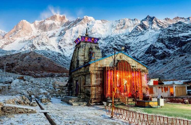
The drive to Kaza is one of the most beautiful drives, with deep gorges and the silver Spiti river on one side and sharp, rugged mountains on the other. Across the Spiti river, beautiful villages like Rangrik – with a huge Buddha statue atop a mountain, Pagmo etc come into view. The roads are quite narrow but the local drivers and buses deftly navigated these. Reach Kaza at about 6:00 pm and halt at the guest house next to the beautiful monastery. Do not miss out on the delicious local Spitian dishes.
Altitude: 12,467 ft (3,800 m) to 6,725 ft (2,050 m)
The journey back to Manali today starts at 4.00 am, so you can reach on time to take your bus to Delhi. The return journey is quite nostalgic as you drive through familiar terrain.
The day starts with a short, one hour drive to Kibber. This small village, located in the midst of a narrow valley, is often referred to as one of the highest inhabited villages in the world at an altitude of 14,108 ft. After dropping off your backpacks in the homestay at Kibber, you will visit the much revered Key Monastery. You will get a feeling that you have crawled back into the pages of history. This medieval monastery sits atop a hill while the Spiti river trickles past the desert mountain valleys that stretch as far as your eyes can see.
Cost Includes
- Hotels n camps.
- Meals according to MAP .
Cost Excludes
- Cost of lunches
- Any personal expenses, room service and special orders, mineral waters, alcoholic and non alcoholic beverages, porterage, tips, phone calls, laundry etc.
- Any extra excursions or sightseeing apart from the above specified itinerary
- Camera fees, guide charges not included in the inclusions
- Medical and Insurance of any kind
- Any incidental and other expenses which are not specified in the inclusions
FAQs
Visa requirements depend on the country you’re visiting (Nepal, India, Bhutan, etc.). Most travelers need a tourist visa, which can be obtained online or on arrival for some countries.
Trekking expeditions (Everest Base Camp, Annapurna Circuit, etc.)
Cultural tours (monasteries, heritage sites)
Adventure sports (rafting, paragliding)
Wildlife and nature tours
The fitness level depends on the trek. Moderate fitness is required for shorter treks, while longer and high-altitude treks require good physical conditioning and stamina.
Essential items include:
- Proper trekking gear (boots, backpack, trekking poles)
- Warm clothing (thermal wear, down jacket)
- Personal essentials (medications, sunscreen, sunglasses)
- Important documents (passport, travel insurance)
Yes, travel insurance covering high-altitude trekking, medical emergencies, and trip cancellations is highly recommended.
Yes, permits are required for many trekking regions, such as:
- Nepal: TIMS card and national park permits
- India: Inner Line Permit for certain areas
- Bhutan: Special travel permits arranged by the tour operator
You will typically find local cuisine (dal bhat, momos), as well as some Western dishes in tea houses and lodges along popular routes.